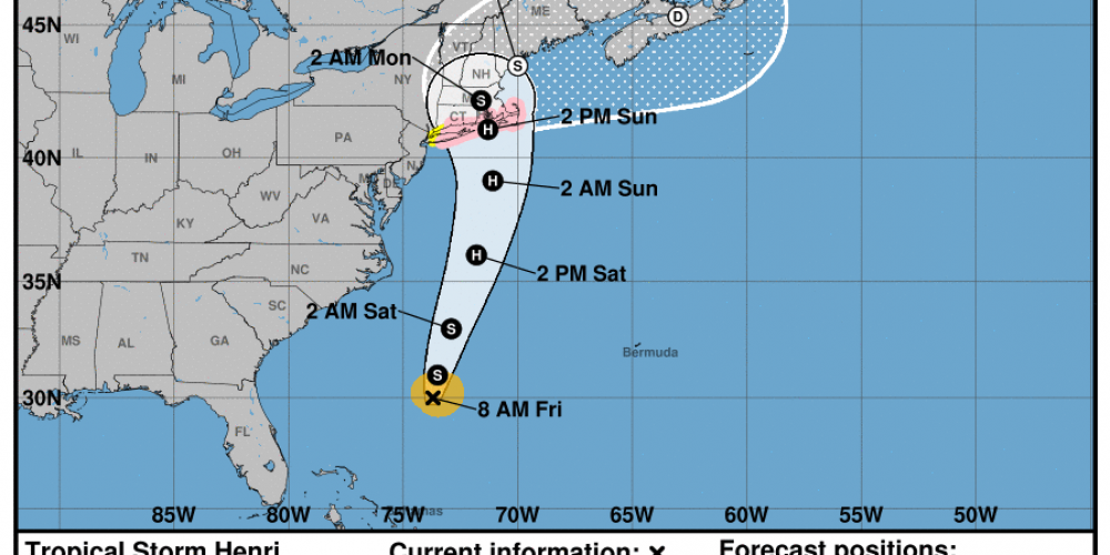
| Hurricane Henri impacts to be felt Sunday into Monday. |
| Hurricane Henri is expected to threaten New England this weekend. The track of Henri is somewhat uncertain, however, the following is known: -Henri will come close to shore with at least 60mph winds and significant rain impacts. -Watches will be put in place today. -Dangerous storm surge and rip tides are expected on the Cape and south facing beaches. -There may be power outages and trees down, especially if the storm tracks closer to land. DO NOT WAIT TO PREPARE. In preparation for this storm and others this hurricane season, the MCC wants to remind you of a few very important things: -The MCC has a hurricane and preparedness section of its website. Simply click the link to our downloads page and click the hurricane tab. https://knowflood.org/downloads -Refer to the website https://cera.coastalrisk.live/ for the latest hurricane information. -There may be coverage to prepare for a flood found in your flood insurance policy. Please refer to your policy for coverage information -Before the storm, you should photograph and document your building and contents pre-loss for insurance reasons. -A preparation guide for what to do before, during and after a storm is found here. -If you don’t have a flood insurance policy, there is typically a 30 day wait for a policy to be effective. So unfortunately, it is too late to purchase coverage for this event. Remember, you don’t need to live in a flood zone to purchase flood insurance. You should consult with your insurance advisor to see if purchasing flood insurance might be a good idea in the future. As of writing this, the expected track is below. This may change and the MCC will update you if the track becomes more dangerous. |


